top of page
IMG_6773_edited.png

The islands that have measured their habitability

Kökar was the first. Since then, islands around Europe have done their own habitability analysis. Here's a short look at each.

overview of habitability analysis 25 islands

Åland

kitchen overview

This is where habitability was born in 2020, by half the island's population.

Population:
Winter time 221

Summer time 1,500
 

Surface:
Land 59 km2

Sea 2.195 km2
 

Distance:
Road 30 min

Ferry 2,5 tim

bird overview

First island to follow Kökar in 2023

Population:
Winter time 501

Summer time 2,800

Surface:
Land 135 km2

Sea 1,734 km2

Distance:
Road 30 min

Ferry 30 min

kumlinge overview

Very well locally anchored study in 2023

Population:
Winter time 305

Daylight Saving Time 458

Surface:
Land 99 km2

Sea 766 km2

Distance:

Road 30 min

Ferry 2 hours

soot tongue overview

Finland's (worlds?) smallest municipality with strong liveability in 2023 and now

Population

Winter time: from 92 to 108 (2026)

Summer time 6,000

Surface:

Land 28 km2

Sea 314 km2

Distance:

Road 25 min

Ferry 1 hour 15 minutes

brändö översikt

Starting its habitability study in the fall of 2026 together with Vårdö.


Population

Winter time 430
We don't know about summer time yet.


Surface

Land 108 km2
Sea 1,535 km2

Distance:

Road h min

Ferry min

care overview

Starting its habitability project in the fall of 2026 together with Brändö.


Population:

Winter time: 459
Summer time: not yet clear


Surface:

Land 109 km2
Sea 572 km2


Distance:

Road 1 h 10 min
Ferry 4 min

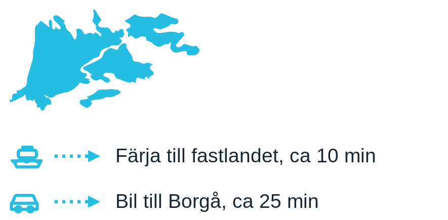
Borgå archipelago

Pellinge overview

An archipelago including Storpellinge, Lillpellinge, Tullandet, Ölandet, Sundö and Klovharun (Tove Jansson's island). Habitability analysis 2023.

Population:
Winter time about 350 (247 permanent residents)
Summertime approx. 4,000 (midsummer); 2,134 part-time residents, 38,000 visitors/year

Surface:
Land 27 km²
Sea 223 km²

Distance:
Ferry 5min
Car 30 min 

Emsalö overview

One of three islands in the Porvoo archipelago, with a fixed bridge connection to the mainland since 1992.

Habitability analysis 2023.

Population:
Winter time 373 (permanent residents)
Significantly more in the summer; 472 summer cottages, 79,500 visitors/year

Surface:
Land 34 km²
Sea 43 km²

Distance:

Bridge to the mainland

Car, Borgå 4–15 km away

Vessö overview

Vessölandet is a 12 × 5 km island, separated from the mainland by the narrow Fladan Strait with a 10 m long bridge. Habitability analysis 2023.

Population:
Winter time 532
Summertime – approx. 1,349; 560 holiday homes, ~180,000 visitors/year

Surface:
Land 54.7 km2
Water 24.2 km2

Distance:
Bridge to the mainland
Car 10 km to Porvoo

Sibbo archipelago

sibbo eastern overview

In the eastern archipelago of Sipoo, the islands of Kitö and Löparö are connected to the mainland via two bridge connections.


Population:

Winter time 70
Summer Time 558


Surface:

Land 8 km2
Water 10 km2


Distance:

Highway 20 min

Car 30 min

sibbo west overview

The western and central Sipoo archipelago includes 14 islands without fixed road connections.

Population:

Winter time 74
Summer Time 2,682


Surface:

Land 18 km2
Sea 356 km2


Distance:

Boat 30 mins

Car 30 min

Turku archipelago

west bay overview

Västanfjärd


Population:

Winter time 725

Summer time little difference


Surface:
Land 100 km2
Sea 49 km2


Distance:

Car 15 Kimito / 45 min Turku

as an overview

The main islands are Storlandet and Lillandet. Habitability analysis 2024–2025.

Population:
Winter time 1454
Summer Time 12.562


Surface:
Land 250 km²
Sea 1,438 km²

Distance:
Ferry to Pargas, about 10 min.
Car to Turku, about 40 minutes

corporate overview

Korpo measured its habitability in 2020 under the leadership of the Archipelago Sea Biosphere Reserve.


Population:
Winter time 1,454
Summer time: 12.652


Surface:
Land 250 km2
Sea 1,438 km2


Distance:
Car to Turku 45 min

houtskär overview

Houtskär conducted its study at the same time as Iniö, Korpo and Nagu


Population:
Winter time 536
Summer time 3.889

Surface:
Land 121 km2
Sea 448 km2


Distance:
Land and sea route in total approx. 2 h 30 min

iniö översikt

The former archipelago municipality of Iniö studied its habitability in 2025


Population:

Winter time 184
Summer time 2.820


Surface:

Land 65 km2
Sea 271 km2


Distance:

Varies greatly between 1 and 2 hours depending on where in Iniö you are going.

Saimaa

kesamon overview

South of Savonlinna


Population:

Winter time 73
Daylight Saving Time 272


Surface:

Land 49 km2
Lake (Pihlajavesi part of Saimen) 85 km2


Distance:

Bridges and road 40 min to Savonlinna

moinsalmi overview


Three islands in Pihlajavesi southeast of Savonlinna


Population:

Winter time 498
Daylight Saving Time 1,095


Surface:

Land 108 km2
Lake 85 km2


Distance:

Bridge and road 50 min to Savonlinna

ahvensalmi overview


Located on the islands of Iso and Pieni Ahvensalo north of Savonlinna


Population:

Winter time 183
Daylight Saving Time 648


Surface:

Land 48 km2
Lake 63 km2


Distance:

Road1 hour to Savonlinna

Denmark

avernako overview

Starting its habitability study in the fall of 2025


Population:

Winter time 110
Summer time unclear but has 40,000 visitors per year


Surface:

Land 6 km2
Located in the Great Belt


Distance:

Ferry 30 min (1 hr 10 min via neighboring island Lyø)

Car 10 min to Svendborg

strynö overview

Denmark


Population:

Winter 197
Summer approx. 16,000 tourists


Surface:

Land 5 km2
Located in the South Funen Archipelago


Distance:

Ferry 35 min
Highway 10 min to Svendborg


omo overview

Starting its habitability study in the fall of 2025


Population:

Winter time 116
Summer time unclear. 35,000 visitors per year


Surface:

Land 4.5 km2

Distance:

Ferry 50 mins

Highway 10 min to Slagelse

veno overview

Denmark


Population:

Winter 178
Summer approx. 55,000 tourists

Surface:

Land 57 km2
Located in the South Funen Archipelago


Distance:

Ferry 267 m from shore
Highway 10 min to Svendborg


Croatia

show overview
Vis

An island with two municipalities. Starting the habitability study in 2026.


Population:

Winter time 3,313
Summertime: 2,000 holiday homes + 100,000 tourists


Surface:

Land 90 km2
Sea Croatian island municipalities have maritime rights along their shores, but Vis's protected marine park is 6,661 km2 in area


Distance:

Ferry 2 h 20 min
Catamaran 1 h 30 min

brac overview

Braç is a very large island with a famous beach and eight municipalities, of which only Supetar is analyzing its habitability.


Population:

Winter time 3,213
Daylight saving time: not yet known


Surface:

Land 39 km2
Only ports and beaches fall under the jurisdiction of the municipality


Distance:

Ferry 50 mins

bottom of page